

IHO & Japan move to strengthen cooperation
Reliable ocean data is essential to safe shipping, port operations, marine environmental protection and coastal resilience. Japan and the International Hydrographic Organization are looking to deepen cooperation on digital hydrography and technical capacity, including support for developing countries.
Accurate information about the world's oceans is a foundation of international trade, maritime safety and environmental management, yet vast areas of the seabed remain inadequately surveyed by modern standards. As shipping and marine industries become increasingly reliant on digital navigation, the quality and accessibility of hydrographic data are gaining importance for governments, ports and businesses.
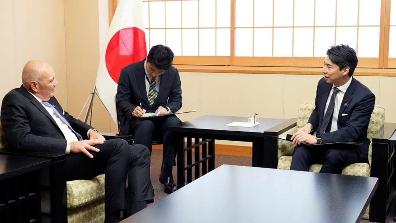
This was among the issues underpinning discussions between Japan and the International Hydrographic Organization (IHO) on October 19, when Japan's State Minister for Foreign Affairs, NAKASONE Yasutaka, received Rear Admiral Luigi Sinapi, the organisation's Secretary-General, in Tokyo.
The approximately 35-minute meeting marked Sinapi's first visit to Japan since assuming office in September 2026. Both sides highlighted longstanding cooperation between the IHO and Japan's public and private sectors, reaffirming their commitment to strengthening collaboration on hydrographic activities, digitalisation and capacity building for developing countries.
The importance of accurate ocean data extends far beyond producing nautical charts. Hydrography involves measuring and describing the physical features of oceans and navigable waters, including seabed depth, coastlines, tides and other information relevant to maritime activity.
For a commercial vessel entering a busy port, reliable depth measurements can help determine safe passage and prevent grounding. For port authorities, updated seabed information supports dredging, channel management and infrastructure planning. For offshore energy developers, accurate seabed mapping is important when assessing locations for subsea cables, pipelines and wind farms.
The consequences of inaccurate or outdated information can be serious. A chart that does not reflect changes in seabed depth, newly identified hazards or altered coastal conditions can compromise navigational safety. The International Maritime Organization requires ships to carry adequate and up-to-date charts under the International Convention for the Safety of Life at Sea, underscoring the importance of dependable hydrographic information.
The next challenge is ensuring that hydrographic information can be updated, exchanged and used efficiently across increasingly sophisticated maritime systems.
The IHO is advancing the transition towards digital hydrographic products and services, including the S-100 Universal Hydrographic Data Model. The framework is designed to support the integration of different types of marine information, enabling electronic navigation systems to use data beyond traditional nautical charts.
This development could improve how ships access information on water depth, navigational hazards, tides and other conditions. More consistent data standards can also help information move between national hydrographic offices, maritime authorities and technology providers.
Digitalisation, however, depends on more than the availability of software. Data must be accurate, current, compatible across systems and supported by appropriate quality controls. Inconsistent information between jurisdictions can undermine the usefulness of digital services, particularly along international shipping routes.
The IHO's work is therefore important in establishing common standards and encouraging cooperation between countries responsible for surveying and charting their waters.
Hydrographic information also has a growing role in understanding environmental change and protecting coastal communities.
Reliable seabed and coastal measurements contribute to modelling storm surges, coastal inundation and the effects of rising sea levels. Combined with oceanographic and meteorological information, they can help scientists and authorities assess risks to coastal settlements, ports and critical infrastructure.
Seabed data also supports marine research, fisheries management and the planning of offshore projects. Establishing accurate baseline information is a necessary step towards monitoring changes in marine environments and making informed decisions about their use.
For island nations and developing coastal states, these capabilities can be particularly important. Limited surveying resources and technical expertise can leave gaps in national hydrographic coverage, affecting navigational safety and the ability to plan maritime development.
This explains why capacity building featured in the Japan-IHO discussions. Training, technical assistance and the development of national hydrographic capabilities can help more countries collect, maintain and share reliable marine data.
Japan's engagement with the IHO brings together its maritime expertise, public-sector capabilities and private-sector technology. As a major trading nation dependent on sea transport, Japan has a direct interest in safe navigation and reliable hydrographic services.
Nakasone highlighted the importance of longstanding cooperation in ensuring navigational safety through hydrographic activities and international collaboration on marine affairs. Sinapi expressed appreciation for Japan's continued support and his intention to maintain close cooperation.
The October 19 meeting did not announce a new funding commitment or specific technical project. It nevertheless reaffirmed the importance both sides place on digital hydrography and strengthening the capabilities of countries that need support.
Ultimately, the value of ocean data lies not simply in how much information is collected, but in whether it is accurate, accessible and usable. As maritime transport, offshore infrastructure and coastal planning become more data-dependent, international standards and cooperation will remain essential to ensuring that decisions made at sea and along the world's coastlines are based on dependable information.